Capítulo 1
Rediscovering Our Primal Connection to the Natural World
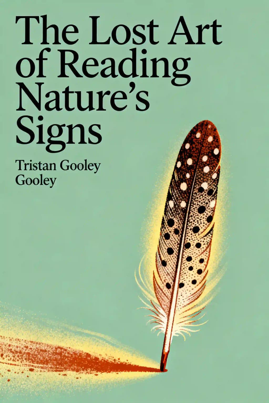
When I first encountered Tristan Gooley's work, I was struck by a simple yet profound realization: we've forgotten how to read the world around us. Ten years ago on a Brittany beach, Gooley observed an Italian honeymoon couple through subtle clues in their jewelry, body language, and hotel choice. Later that day, using signs from birds, lichens, insects, clouds, sun, and moon, he accurately predicted their beach bonfire would be extinguished by rain and tide shortly after sunset. This exemplifies the lost art he's dedicated his life to reviving.
The book has garnered a cult following among outdoor enthusiasts and has been praised by National Geographic as "a must-have for outdoor adventurers." Even celebrities like Bear Grylls have endorsed Gooley's work, calling him "a master of his craft." What makes this book culturally significant is how it bridges the growing disconnect between modern humans and the natural world, offering practical skills that were once common knowledge but have been largely forgotten in our digital age.
Capítulo 2
Unlocking Nature's Hidden Language
One small clue can dramatically transform how we perceive our surroundings. Consider what you might deduce from the faint scent of musty smoke on a cold morning when no fire is visible. This likely indicates a temperature inversion-warmer air trapping cooler air near the surface-creating a "sandwich effect" where smoke, sound, light, and radio waves behave unusually.
During inversions, sounds travel further and louder; you'll hear distant airports, roads, or trains normally inaudible. Light refracts differently, creating optical illusions like the Fata Morgana where distant objects appear to levitate. Radio waves, especially VHF, travel further too-a technique once used to eavesdrop across the Iron Curtain during the Cold War.
These inversions can create dangerous conditions. In London in 1952, a severe inversion trapped pollutants close to the ground, creating deadly smog that killed over 11,000 people from respiratory problems. While fascinating from a natural observation perspective, these events remind us that reading nature's signs isn't merely an intellectual exercise-it can be a matter of life and death.
The key to reading landscapes effectively is Gooley's "Get Sorted" method-an acronym for Shape, Overall character, Routes, Tracks, Edges, and Detail. The first three steps build a mental picture of your surroundings, while the last three reveal hidden clues. This systematic approach transforms overwhelming visual information into meaningful patterns and stories.
Think about it: have you ever noticed how the shape of the land influences everything around you? Understanding topography isn't just for map enthusiasts-it's fundamental for safe navigation. Gooley learned this lesson at fourteen when planning a foolhardy straight-line route up Pen y Fan in Wales. His father, a former SAS officer, built a mud model showing him how to read contour lines as three-dimensional features, a lesson that saved him from disaster.
Capítulo 3
Trees: The Living Compass
Trees offer practical navigation tools and insights beyond their mystical associations. Each species tells a story about its environment, creating a natural map of the landscape. Sycamores and ashes mark floodplains with their preference for fertile, wet soils. As you approach the coast, these trees disappear, intolerant of salt. Beeches thrive on chalk and die in waterlogged soil, ensuring dry walking conditions underfoot. Alders and willows signal wet areas near streams and spring lines.
Have you ever noticed how trees grow differently depending on their position? Individual tree shapes reveal their life stories, sculpted by environmental forces. Height correlates with water availability-dry soils host shorter trees, especially in windy areas. Sun shapes trees three ways: influencing species distribution by latitude (tall, thin trees in high latitudes versus rounded shapes in lower latitudes), affecting growth strategy (slow-growing robust species like yew versus fast-growing vulnerable ones like birch), and creating asymmetry.
Northern hemisphere trees typically grow fuller on their sun-facing southern side. Phototropism causes the "tick effect"-branches on a tree's north side grow more vertically while southern branches extend horizontally. Wind sculpts trees most visibly in their top branches, which sweep in the prevailing wind direction.
Some exposed trees develop a "wind-tunnel effect," becoming streamlined on their windward side while maintaining straggly growth downwind. The windward side shows tightly packed branches while the leeward side appears looser with more light penetration. Solitary "lone straggler" branches typically point downwind, having been tugged by countless gales.
Storms leave lasting signatures in woodlands that reveal wind direction and land history. Trees typically fall along storm wind paths, creating discernible patterns across landscapes. After falling, most trees survive-conifers regrow from their tips while deciduous trees sprout from their lowest living limbs. When trees twist and fall, their upturned root balls create distinctive mound-and-dip formations that persist for centuries, pointing toward the storm's origin.
Even tree bark holds directional clues. According to 18th-century missionary Father Joseph-Francois Lafitau, the Iroquois used trees as natural compasses, observing that bark appears darker and duller on the north side. For confirmation, they would cut into trees, noting that growth rings are thicker on the north-facing side and thinner toward the south.
Capítulo 4
The Secret Language of Plants
All plants we encounter have succeeded by adapting to their environments. While some tolerate a wide range of conditions and reveal little, others are hypersensitive and can tell us remarkable stories about their surroundings.
Stinging nettles thrive only in phosphate-rich soil, often indicating human activity or habitation. Finding isolated nettle patches can reveal ruins, burial sites, or abandoned structures. Elder and ground ivy share this phosphate-loving trait. Pineappleweed, identifiable by its pineapple scent and yellow-green cone-shaped florets, indicates disturbed ground, while plantains (nicknamed "white man's footprint" by Native Americans) flourish along well-trodden paths.
Plants provide reliable directional indicators through their relationship with light. In Ireland's Ballycroy National Park, the contrast between heather-covered and bare sides of drainage ditches reveals south-facing versus north-facing aspects. Daisies flourish in open areas sloping southward but are scarce on northern sides of buildings and hedges. Forget-me-nots form dense colonies on the southern sides of flowerbeds.
Ivy holds six navigational secrets related to its unique growth patterns. First, juvenile ivy displays negative phototropism, growing away from light to find host trees, often pointing from south to north at tree bases. Second, mature ivy becomes positively phototropic, growing more abundantly on the sunnier southern sides of trees. Third, ivy's clinging roots grow away from light, appearing more numerous on the northern sides of trees. Fourth, ivy grows more commonly near woodland edges than centers, helping lost wanderers find their way out. Fifth, ivy appears more frequently on north-facing slopes. Finally, ivy leaf orientation differs between sides of a tree-leaves on the southern side point more downward to capture horizontal light, while northern-side leaves point more horizontally to catch light from above.
Plants function as precise timekeepers, responding to the Earth's orbit and seasonal light changes. St. John's wort flowers after the summer solstice when days begin shortening. Early woodland flowers like primroses and anemones emerge before the canopy closes, taking advantage of open skies. Plants pass the seasonal baton in predictable sequences or "guilds"-areas rich in primroses and anemones will soon display bluebells and violets.
Capítulo 5
The Microscopic Compass: Mosses, Algae, Fungi and Lichens
These small organisms colonize surfaces exposed to the elements over time, each with specific environmental requirements that reveal clues about their surroundings. Their presence or absence tells stories about moisture, light, and age of surfaces.
Mosses require water for reproduction, making them reliable indicators of moisture-retaining areas. They thrive in shady locations, particularly on north-facing surfaces where moisture persists longer. When other causes of dampness are eliminated, moss growth can effectively indicate northerly direction.
Algae growth reveals subtle environmental differences between surfaces. On signs and other inhospitable surfaces, the north-facing side typically hosts green algae while the south-facing side remains clean. This occurs because the southern exposure receives direct midday sunlight that regularly dries the surface, creating conditions too harsh for algae. In challenging environments where water availability limits life, sunlight effectively "polishes" surfaces free of algae and mosses.
Fungi reveal more sophisticated stories than mosses or algae, thriving in moist, shady environments rich in nutrients. Though often hidden underground, certain species offer valuable landscape clues. The iconic fly agaric indicates acidic woodlands with birches nearby-a sign you might be approaching woodland edges. Lilac milkcaps signal alder trees and water proximity, while tar spot fungus on sycamore leaves indicates clean air.
Lichens, those "poor little peasants of nature," form beautiful partnerships between fungi and algae that thrive where neither could survive alone. These resilient organisms serve as environmental indicators-their abundance signals pure air, as evidenced by London's Botanic Gardens where lichen counts rose from six during industrial pollution to seventy-two recently. Hair-like lichens indicate especially fresh air, while gelatinous lichens prefer moist, shady sites.
The bright orange Xanthoria parietina forms a natural compass, changing from vibrant gold in direct sunlight to duller green-gray in shade. Slow-growing crustose lichens like Rhizocarpon geographicum (map lichen) help date undisturbed surfaces-growing roughly one millimeter yearly, a 40cm patch suggests 400 years of stability.
Capítulo 6
Reading the Sky: Weather Prediction Without Technology
The sky's colors reveal atmospheric conditions and weather patterns. Without atmosphere, Earth's sky would be black like the moon's. On clear days, the sky transitions from pure blue overhead to white at the horizon due to light scattering. This pattern serves as a baseline for weather prediction-any deviation signals changing conditions.
Weather patterns follow seasonal lags-June receives more solar energy than December, yet isn't our warmest month because oceans warm and cool slowly, affecting air temperatures. This explains why October sea swims can be surprisingly mild while May dips feel shockingly cold.
To predict daily conditions, focus on two key elements: wind and clouds. Begin each walk with a top-to-bottom check-first observing celestial bodies, then atmospheric conditions, and finally ground-level details. After checking the sky, assess the wind's character: its strength, direction and feel. A light but surprisingly cold wind might be northerly or very dry. Monitoring these wind characteristics prevents weather surprises, as significant weather changes are always accompanied by wind shifts.
Weather winds operate at two levels-upper and lower. The upper winds move steadily west to east like "giant parents," pulling the more changeable lower winds (the "unruly children") along beneath them. A weather front occurs when cold air is replaced by warm air or vice versa, signaled by dramatic shifts in lower wind direction relative to upper winds.
Using the "crosswinds method," stand with your back to the wind and observe high clouds: if they move left to right, warm air and rain are approaching; right to left indicates a cold front has passed and weather will improve; same direction means no imminent change. Remember: major wind direction shifts precede all significant weather changes, and counterclockwise shifts typically mean worsening conditions.
Higher cloud bases indicate drier air and less chance of imminent rain. Deepening or lowering clouds suggest deteriorating weather, while shallowing or rising clouds signal improvement. Multiple cloud types mean unsettled conditions. The key cloud types are: cumulonimbus (tall, dark giants with anvil tops), cumulus (fluffy sheep-like clouds), cirrus (high wispy streaks), and cirrostratus (high shapeless blankets).
Weather lore contains both wisdom and nonsense, requiring careful evaluation. The most reliable sayings connect observable natural phenomena with basic meteorological principles. For instance, "A rainbow at night, fair weather in sight; A rainbow at morn, fair weather all gorn" works because it combines two facts: weather typically moves from west to east, and rainbows appear opposite the sun, revealing where rain is located.
Capítulo 7
Celestial Navigation: Finding Your Way by the Stars
Few people today can navigate by stars, leading to the misconception that it must be difficult. While determining exact position requires specialized tools like sextants, finding direction using stars is surprisingly simple. The key to understanding stellar navigation is recognizing that "north" always means "toward the North Pole," and the night sky contains a fixed point directly above this pole.
The easiest method for finding the North Star (Polaris) is using the Big Dipper's pointer stars-the two stars that form the outer edge of the dipper's bowl. The North Star is always located five times the distance between these pointers in the direction they indicate. The Big Dipper rotates counterclockwise around Polaris throughout the night, sometimes appearing sideways or upside down, but its relationship to the North Star never changes.
Cassiopeia is invaluable for finding the North Star as it always appears on the opposite side of Polaris from the Big Dipper. When one is low in the sky, the other is high, making them complementary navigation tools. Cassiopeia forms a stretched "W" shape that rotates around the North Star. To locate Polaris from Cassiopeia, imagine a line across the top of the "W," rotate it ninety degrees counterclockwise, and double its length.
There's a direct relationship between your latitude and the angle of the North Star above the horizon-they're identical. At the North Pole (90 north), Polaris appears 90 above the horizon; at the equator (0), it sits on the horizon. In England at roughly 50 north, the North Star is 50 above the horizon. This relationship allows navigators to determine their latitude quickly, a technique used since ancient times, including by Columbus.
Unlike the sun, moon and planets, stars rise at fixed points on the horizon night after night. Some stars rise precisely due east and set due west, making them valuable for navigation. Mintaka, in Orion's belt, rises and sets within one degree of true east and west. For summer navigation when Orion isn't visible, Aquila serves a similar purpose-if you spot it near the horizon, you're facing either east or west.
Capítulo 8
The Sun and Moon as Navigation Tools
The sun serves as both calendar and compass, reaching its highest point due south each day at true midday (halfway between sunrise and sunset). The sun rises in the eastern sky and sets in the western sky, but its exact position varies seasonally. In the US and UK, summer sunrises occur near northeast while winter ones happen near southeast.
Ancient cultures used these predictable patterns to create solar calendars like Peru's Chankillo, while Pacific navigators used sunrise/sunset directions as compasses. The midday sun's height also indicates both latitude and season-in New York, it reaches only 2.5 fists above the horizon in December but 7 fists in June, while Los Angeles consistently sees the sun three knuckles higher than New York due to its lower latitude.
Sundials were more dependable than early mechanical clocks, used by train stations to set time as recently as the 1920s. While precise timekeeping with the sun is a refined art, getting a rough idea is simple: shadows shorten in morning, lengthen in afternoon, and reach their shortest at midday. The distance between shadow marks at different times measures elapsed time.
The moon follows predictable patterns we can use for navigation and planning night activities. You can determine the moon's age by observing which side is illuminated-if the left edge is dark, it's less than 15 days old; if the right edge is dark, it's more than 15 days old. Each day, the moon moves eastward 12 relative to the sun (about a fist width plus a knuckle), rising approximately 50 minutes later each day.
If you see a crescent moon high in the sky, extending a line from its horns down to the horizon points roughly south (from northern latitudes). This method becomes less reliable when the crescent is low near the horizon. Any moon at its highest point in the sky is due south, and the shortest shadow cast by the moon creates a perfect north-south line.
Capítulo 9
The Secret Language of Animals
Animals perceive a much more detailed world than humans do. A simple experiment proves their vigilance: place a small piece of stale bread in an open area and watch as insects or birds quickly investigate it, while humans would likely never notice such a small item. From hawks spotting tiny shrews from hundreds of feet above to butterflies that stop flying when clouds block the sun, the animal kingdom notices almost every tiny shift in our surroundings.
Animals are professionally curious, constantly mapping their surroundings to avoid predators and find food and mates. They communicate constantly about threats and opportunities, much like tourists sharing news about great spots or dangers at a beach resort. Their vigilance is remarkable-as demonstrated by a pigeon that knew to fly away when a boy stepped outside the back door of a house, despite being visible only from the front.
Birds typically detect our presence long before we spot them, often waiting silently until the last moment before making a frantic escape. Their warning systems create "bird plows"-sequential flights in the same direction that alert all nearby animals to danger. By staying still and observant, we can use these reactions to detect approaching people or animals.
Birds make sounds for specific reasons: marking territory, locating companions, begging for food, scaring intruders, or warning others. Ironically, the more beautiful and elaborate the birdsong, the less useful information it contains for nature readers. Alarm calls provide the most valuable intelligence-evolution has shaped these to be simple, high-pitched, staccato sounds that warn others without revealing the caller's exact location.
Begin by noticing visual clues-birds hopping to higher branches when concerned about ground threats. Next, learn to recognize the background "soundtrack" of birds and its absence. Companion calls serve as constant safety check-ins between birds, and when this chatter suddenly stops, it signals concern about a predator or intruder. Moonshiners evading law enforcement and hunters tracking prey have long relied on this silence as warning.
After mastering the detection of bird silences, graduate to recognizing alarm calls. Listen for the shift from companion calls and territorial songs to shorter, deeper, louder staccato alarm calls, often accompanied by birds jumping to higher branches and pumping their tails.
Capítulo 10
Urban Navigation: Reading the City's Natural Signs
There's an old French saying, "Avec une bouche, on va a Rome," and a modern equivalent might be, "Avec un iPhone, on va a San Francisco." Both methods work sometimes-we can find answers in towns by asking people or searching online. But most of a town's strange tapestry escapes us if we rely entirely on others.
When exploring a new town, it helps to zoom from broad to narrow, then scan from top to bottom. Note major natural features first: rivers, hills, coastlines. Then observe the man-made hills-buildings get higher toward town centers and financial districts due to space pressure and higher rents. Very tall buildings create strange wind patterns, sometimes powerful enough to close shops at their base or even cause fatalities.
Though each individual in a city has their own destination, large numbers of people behave predictably. Follow the morning flow of people to find a station, or go against the afternoon flow. At lunchtime, workers head from high-rise offices to parks, sidestepping mothers with strollers and dog waste. Saturday flows shift toward retail areas.
Some businesses thrive while others fail based on location. People walk on the sunny side of streets in northern regions, creating premium retail spaces with higher rents. Commuters take different routes to and from stations, typically buying more on their homeward journey. Every shop reflects local habits-florists near hospitals, newsagents near bus stops, fast food near schools.
Major city roads follow radial patterns, flowing in and out like arteries. A highway on the northwestern side of a city will likely run northwest/southeast. Road networks contain hidden codes-in the US, odd-numbered interstate highways run north-south (with numbers increasing west to east), while even-numbered ones run east-west (with numbers increasing south to north).
Industry clusters near rivers, leaving soot patterns carried by prevailing winds. Building design responds to climate-northern buildings prioritize warmth with south-facing aspects, while tropical buildings like Tampa's tobacco factories align east-west for cooling airflow. Houses near parks command premium prices, with freshly-painted exteriors reflecting wealth, while weathered houses among them suggest either elderly residents who pre-date gentrification or younger tenants.
Churches reveal wealth patterns through their expensive imported stone, with isolated churches hinting at historic population decimation. Most align east-west with altars eastward, though slight variations often match sunrise on the patron saint's feast day. The southern side was considered holiest, with churches typically built on the northern part of churchyards, allowing southern approaches.
Capítulo 11
Coastal and Water Navigation
Coastal environments reveal distinctive patterns where land meets sea. Salt-laden winds create specialized ecosystems where only salt-tolerant plants thrive. Beach sand tells stories through its composition while seaweeds occupy different tidal levels. The sea surface holds readable patterns-from boat wakes to wave signatures.
Tides follow predictable patterns despite their complexity (influenced by 396 factors including the sun and air pressure). The moon governs their basic rhythm-two high and two low tides daily, each approximately six hours apart, with the cycle shifting about 50 minutes later each day. Spring tides follow new and full moons with maximum range between high and low water, while neap tides occur after half moons with minimal range.
Still waters reveal nature's subtlest patterns. Only extraordinarily calm surfaces reflect distant objects like trees or mountains-these "mirror-like" moments rarely last long. Even seemingly still water shows gentle ripples where light and dark reflections meet. Rivers follow predictable patterns: they never naturally run straight for more than ten times their width, and their bends have a radius 2-3 times their width.
Fish behavior reveals water patterns for the observant walker. Freshwater fish tend to be territorial while saltwater fish follow nomadic patterns with tidal currents-typically more abundant upstream early in tidal flows and downstream later. Saltwater fishing improves during spring tides near full or new moons. In freshwater, surface disturbances create distinctive signatures: dimples from small fish like dace taking insects, "boiling" water from spawning carp, and splashes from jumping salmon or trout.
Beach treasure hunters understand coastal dynamics in sophisticated ways. Lost jewelry follows predictable patterns as beaches essentially "pan" themselves-heavy gold objects sink through lighter sand until reaching harder layers of stones and shells below. The best hunting grounds are "golden holes"-dimples in the sand near breaking waves, especially where waves cross.
Throughout this book, we've explored how nature's many interconnected elements-animals, plants, rocks, soil, water, light, sky and people-provide clues for making predictions and deductions. The key is developing your own techniques and observations, as minimal research funding is directed toward finding clues in nature compared to technology and industry, creating opportunities for independent discoveries.